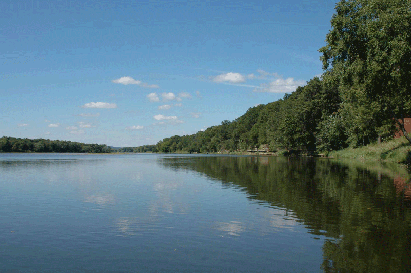
Anyone who lives in or has traveled through the Driftless Area (where Wisconsin, Illinois and Iowa meet) can see at a glance that this is dramatically different from the land encircling it. Because this region was untouched by the last three glaciers, it is defined by rugged ridges and deep valleys that preserve the world here must have all looked like before mile-thick ice sheets flattened the surrounding terrain.
Eric Carson, geologist with the Wisconsin Geological and Natural History Survey does geologic mapping in the Driftless Area of southwestern Wisconsin, and his work in the past year is going to rewrite the natural history of the Wisconsin River. According to Carson, at one time, the Wisconsin River flowed from west to east – the opposite direction of the current current.
A geologic feature, the Military Ridge, runs high and proud, just south of the Wisconsin River bisecting the Driftless region. These days most people know it as a rails-to-trails bike path but it has a long history as a pre-settlement passageway.
In geologic terms, the Ridge is a cuesta, created from cracked and tilted substrata that shoved up a barrier that today creates a regional watershed divide– from which streams north to the Wisconsin and south to the Pecatonica, the Sugar and the Rock.
Up to about a million years ago, the Ridge was enough to turn the flow of the upper Mississippi River to the east at what is now Prairie du Chien along the present-day Wisconsin River bed – it’s waters mixing with Lake Michigan along Door County and eventually disgorging into the Atlantic through the Saint Lawrence Seaway.
Today the Wisconsin River bed gradually drops from east to west. But buried by 50 meters of silt lies the bedrock of the original river that Carson has named the Wyalusing River, and that ancient bed slopes the opposite direction. It’s a case of what is known as “river piracy,”and it’s geology protocol to rename a river whose bed has been stolen.
This information has all been discovered in just the last 8 months!
Carson’s excitement filled the room as he shared his data in a presentation last week at Wednesday Nite at the Lab, “When the Ancient Wisconsin River Flowed East.”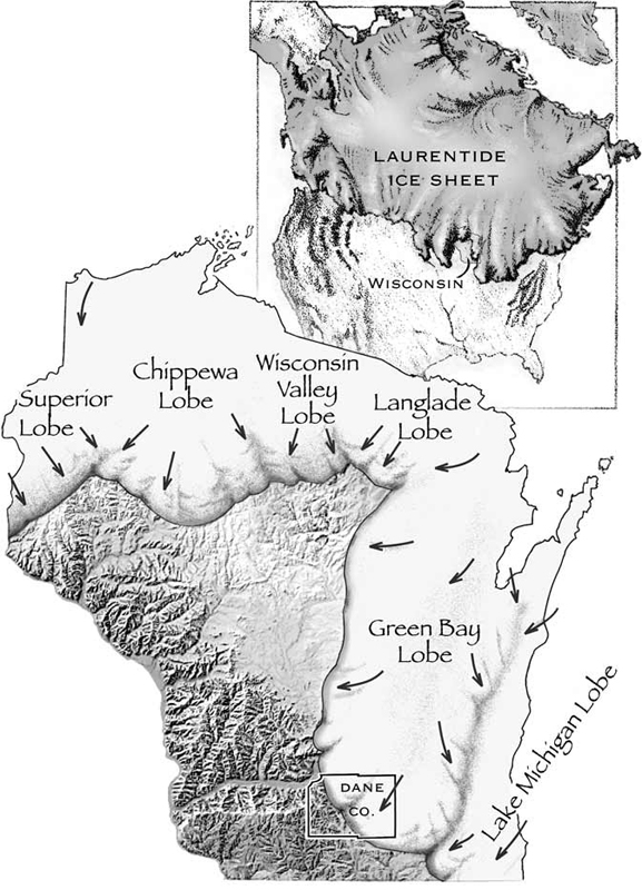
What turned the Wyalusing River around?
A glacier advancing from the northeast blocked the river’s flow, backing up its headwaters and creating a great lake (and that 50 meters of silt). Eventually all that water pouring in burst through, forming a gap in the Military Ridge near Wyalusing State Park. Picture the homes washed away when Lake Delton overflowed in the 2008 flooding see video then multiply it on an inconceivably massive scale.
I am awe struck when I try to visualize geologic events of these proportions!
How Do We Know?
This glimpse of our present world being sculpted by ice and water has been revealed thanks to two new technologies that Carson has been using.
One is a new coring method using Geoprobe coring technology. It’s cheap and fast, compared to previous coring methods. A two-inch barrel is pounded into the ground to establish the top of the bedrock. “It allows multiple holes to be drilled per day, rather than many days per hole,” Carson said. Combining the data from his own boring and the public records from deep-well drilling done for commercial purposes in the state, he was able to clearly chart that the ancient river bed drops to the East.
Roll on, Wisconsin river!
The second new technology is improvements in LiDAR imagery. LiDAR stands for Light Detection and Ranging. It’s an airborne sensing method that uses a pulsed laser to measure the distance to the earth from a plane. It allows scientists to study the surface of the earth, with a resolution that recently improved from about 1.5 meters to about 5 centimeters. It is giving scientists an amazingly detailed look at the contours of the earth, and allowed Carson to see places where the ancient river bed cut terraces into bedrock near Prairie du Chien, Wauzeka and Muscoda.
Research has also established that the Ohio and other rivers out East had their flows pirated away from Saint Lawrence to toward the Mississippi as well in ancient times. Altogether, Carson estimated these piracies cut the flow of the St. Lawrence into the Atlantic by about a third.
Carson undertook this study as part of a multi-county mapping project that will be used in county planning, but it also may help geologists and climatologists identify the causes of shifts in the prehistoric climate that will help us understand our ongoing global warming in greater detail.
Categories: Climate Change
