After a few frosty days and our first meaningful snow, seems like a good time to think about global warming.. Working with information from Wisconsin Initiative on Climate Change (WICCI) , I’ve published a couple of articles (check them out here and here) this past year on what we can expect from climate change here in the Midwest.
One thing that seems certain is that the intensity of storms is already, and will continue ramping up. So it’s comforting to know that our ability to forecast these storms could also be increasing.
 I learned from Bill McKibbin, in his new book Eaarth, A NASA study in 2008 found that raising the temperature of the planet one degree was enough to trigger “a 45% increase in thunderheads above the ocean creating spectactular anvil headed clouds generating supercels with torrents of rain and hail. In fact, total global rainfal is now increasing 1.5% a decade. Larger storms over land now create more lightening; every degree C brings about 6% more lightening.
In just one day in June 2008 lightening sparked 1,700 fires in California. burning a million acres and setting a new state record. ”
 According to a press release this week from the University of Wisconsin-Madison, new use of satellites can give us improved predictive ability and a helpful heads up when destructive storms are forming up.
Check out a great graphic showing our weather satellites in orbit at the National Oceanic and Atmospheric Administration website here
Chian-Yi Liu, a postdoctoral researcher at UW-Madison, is exploring ways to use satellite data to improve thunderstorm prediction.
Currently scientists use data from surface observations and measurements from balloons, which can not get high enough to provide a complete picture of what is happening in the atmosphere. The troposphere, where storms can form, goes up six miles.
Thunderstorms are called “convective storms” because they are powered by differences in air density that cause updrafts and cooling.

..NOAH satellite image taken over the U.S. December 15. http://www.nnvl.noaa.gov/
Convective storms allow the atmosphere to dump excess energy, held in the form of heat and humidity, and release it as wind and especially precipitation. Convection storms are most likely when the atmosphere is unstable,
Liu says. “Our analysis shows that if there is instability at around 30,000 feet, with other storm-favorable conditions, a convective storm will develop in the following three to five hours. Using the top-down view of a satellite reverses our usual way of thinking about convective storms, and may suggest an explanation for storms that arise when they would not be predicted using conventional methods.”

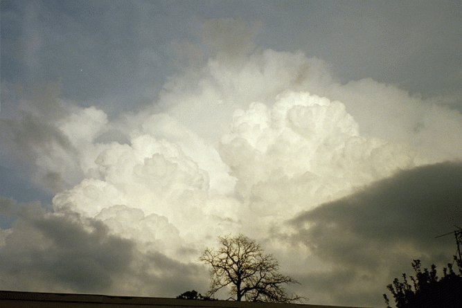
..photo credit http://www.flickr.com/photos/carenmack/3385465805/
Liu works at the Cooperative Institute of Meteorological Satellite Studies (CIMSS) , and he presented his findings at the American Geophysical Union this week along with Steve Ackerman, a professor of meteorology and director of CIMSS.
CIMSS has a good working relationship with National Weather Service, Ackerman says, and has a “proving ground” process that can quickly incorporate research results into forecast methods.
“In my experience, there are not many advances that come along with so much potential to improve forecasts,” he says.
Let’s hope that this technology will help give us a little more time to batten the hatches against those monster storms we have all experienced that come out of “nowhere.”
Categories: Climate Change
