This year I am making a hail pad so that I can report on hail as well as rain as a volunteer for Community Collaborative Rain, Hail and Snow Network (CoCoRaHS) (see my previous blog about CoCoRaHS).
Hailstones form in the turbulent middle and upper levels of thunderstorms. Whenever you look up at those towering thunder clouds, be assured there is hail churning up there. Fortunately for us, most of it disintegrates in the violent storm interior or melts before hitting the ground.
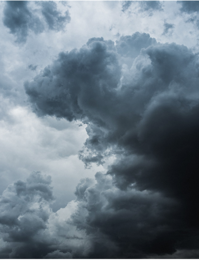
photo credit: Daoudi Aissa
HOW HAIL FORMS
Hailstones generally form around seeds of small ice particles or debris like pebbles, leaves, twigs, nuts and insects that have been lofted into the storm cloud by strong updrafts. The more intense the storm – the bigger the hailstones can be up there.
 Hailstones the size of golf balls occur when over ten billion supercooled droplets accumulate in as little as five minutes. When a hailstone become too big to be supported by the storm cell’s updrafts, it starts down. If it gets caught in a downdraft, it will be hurled toward the ground at more than 100 mph.
The U.S. National Weather Service sizes hailstones from pea-sized to softball-sized, but under the right circumsatances, they can grow much bigger.
HAIL DAMAGE
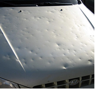
According to the Weather Doctor , Jim Scarlett, meteorologist in charge at the National Weather Service in Aberdeen, South Dakota, remarked “I described this one as cantaloupe-size.” The July 23, 2010, storm sent hailstones that broke through roofs, leaving fist-size holes in interior ceilings smashing through windshields and causing at least five injuries to occupants of cars stranded along I-90. Massive hailstones pummeled the ground and the dents in the ground were still visible the following day, some as large and deep as coffee cans.
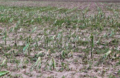
Crops and natural areas suffer torn leaves, broken stalks and plants stripped of foliage.
Hail is one of the most significant thunderstorm hazards to aircraft, according to Wikipedia. When hailstones exceed half an inch, planes can be seriously damaged within seconds. And hailstones accumulating on the ground can also be hazardous to landing aircraft.
And roofs can take a hit too. Sometimes the damage on a roof can be difficult to monitor.Here is a simple guide to roof hail damage.
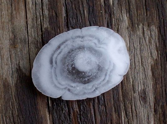
Enter a caWhen sliced through, hailstones have an onion-like layering, alternating between clear and opaque ice. Opaque layers are formed of small, supercooled liquid water drops that freeze rapidly, trapping air bubbles. Clear ice form when the freezing is slower, allowing he air bubbles to escape.
WHEN WE ARE AT RISK FROM HAIL
According to Wikipedia , hail in this region occurs between the months of March and October during the afternoon and evening hours, with the bulk of the occurrences from May through September. Cheyenne, Wyoming is North America’s most hail-prone city with an average of nine to ten hailstorms per season.
If you live in or near Madison, Wisconsin, here is a link to area hail reports.
WHAT YOU CAN DO ABOUT IT
Hail damage is as erratic as the path of a tornado, devastating one field while leaving the next untouched. That’s why I’m putting out a hail pad.
The current generation of weather radar does not directly measure precipitation, only the energy reflected back to the radar from whatever the radar is looking at (rain, hail, snow, insects, etc). The presence of precipitation must be inferred by the amount of returned energy to the radar and, for hail in particular, the location of strong radar echoes in storms. Forecasters look for areas of high reflectivity in middle to upper levels of storms as a sign of large hail, and also look for signs of sustained updrafts that could keep hailstones aloft long enough to become large.
Our knowledge of hail is limited because it tends to occur over small areas for short periods of time. Because CoCoRaHS hail reports are sent directly to the National Weather Service, they can help forecasters track storms and can provide guidance for issuing severe thunderstorm warnings.
Consider joining CoCoRaHS and help provide better information on the frequency, timing, and characteristics of hail storms, as well as rain and snow. With the weather becoming more severe and erratic, citizen scientists can help up our game.
Categories: CITIZEN SCIENCE
